DATOSDELSITIO.ES ≡ Manual Wheelchairs Toilet Womens Hunting Clothing Shop By Brand
  • 1:50,000 Tasmania Topographic Maps

  • Lake Pedder 1:50,000 Topo Map

Lake Pedder 1:50,000 Topo Map

$10.24 $16.59
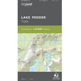
Description Lake Pedder 1:50,000 Topo Map The Lake Pedder 1:50,000 Topographic Map covers the southern half of Lake Gordon and most of Lake Pedder, which are Tasmania’s largest artificial freshwater lakes and feed the hydro-electric Gordon Power Station. Lake Pedder is accessible for trout fishing, kayaking and swimming. Most of the map area falls in Southwest National Park which is part of the Tasmanian Wilderness World Heritage Area. Located in the west, the village of Strathgordon is set deep in the southwest wilderness on the shore of the lake. Mount Anne dominates the area and is the highest mountain in the southwest. The demanding high alpine circuit walk is for experienced walkers. This is an ideal map for fishers, walkers and explorers of this part of the southwest wilderness.
1:50,000 Tasmania Topographic Maps

1:50,000 Tasmania Topographic Maps

  • Meadowbank 1:50,000 Topo Map
    $12.56 $19.96
  • Nicholas 1:50,000 Topo Map
    $12.56 $19.08
  • King William 1:50,000 Topo Map
    $12.56 $21.09
  • Legerwood 1:50,000 Topo Map
    $11.37 $20.12
  • Lake Leake 1:50k Topo Map
    $12.56 $23.35
  • Montagu River 1:50,000 Topo Map
    $32.15 $45.97
  • Lake Pieman 1:50,000 Topo Map
    $13.33 $24.66
  • Meander Valley 1:50,000 Topo Map
    $12.56 $24.36
  • Mount William 1:50,000 Topo Map
    $12.56 $24.11
  • Moulting Lagoon 1:50,000 Topo Map
    $14.75 $19.47
  • Kent Group 1:50,000 Topo Map
    $12.56 $17.7
  • Macquarie Harbour 1:50,000 Topographic Map
    $23.83 $42.42
  • Jerusalem 1:50,000 Topo Map
    $21.62 $40
  • Lake Pedder 1:50,000 Topo Map
    $10.24 $16.59
  • Murchison 1:50,000 Topo Map
    $12.56 $19.71
  • Maria 50k Topo Map
    $12.56 $20.46

© 2026 - DATOSDELSITIO.ES